Widespread snow in NSW
Saturday July 17-19, 1965Related
- Australian Weather News - Links to various material pertaining to this event.
Situation
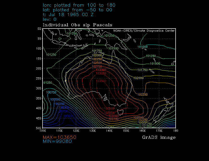
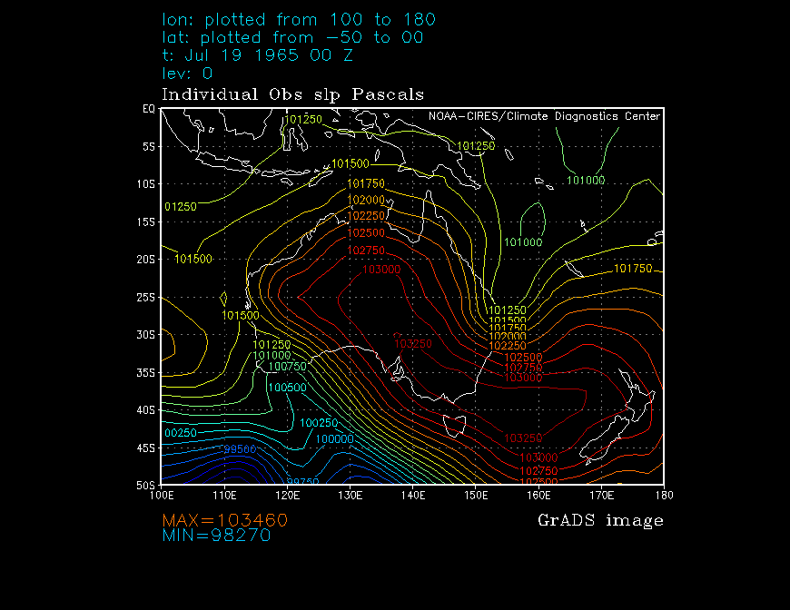
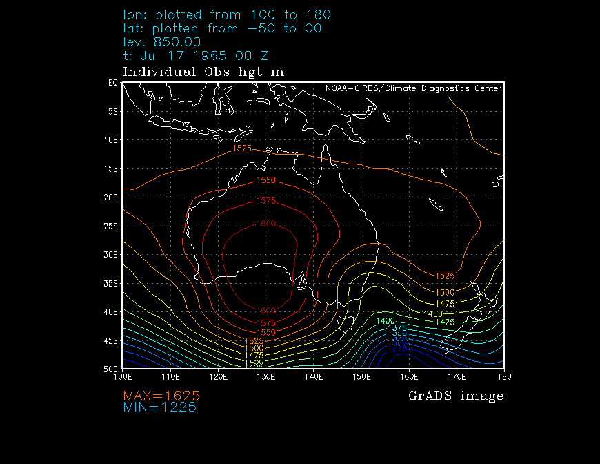
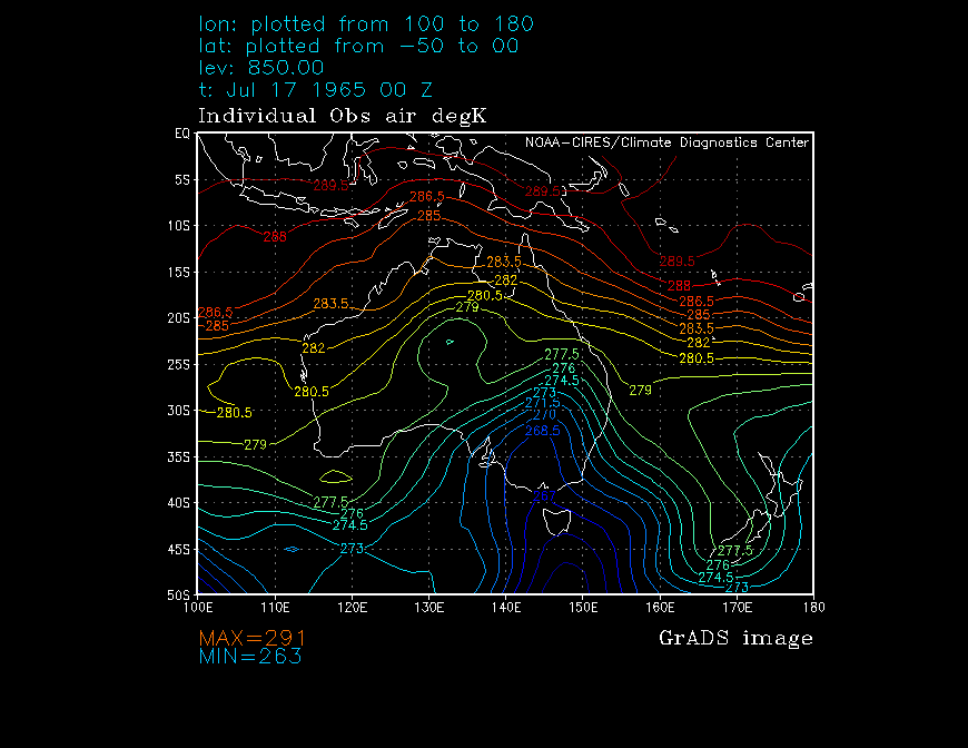
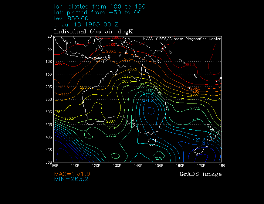
Reanalysis of this event seems to indicate that a strong cold front passed through NSW on the 17th leaving air as cold as -5°C at 850hPa in its wake. Winds turned southerly later in the day and moisture and instability were maintained by a trough off the NSW coast. The sharp upper trough appears to have assisted the development of another trough off the north coast of NSW which when combined with the cradling high to the south, served to provide further moisture and cut off the upper low resulting in prolonged, widespread snow on the NSW ranges.
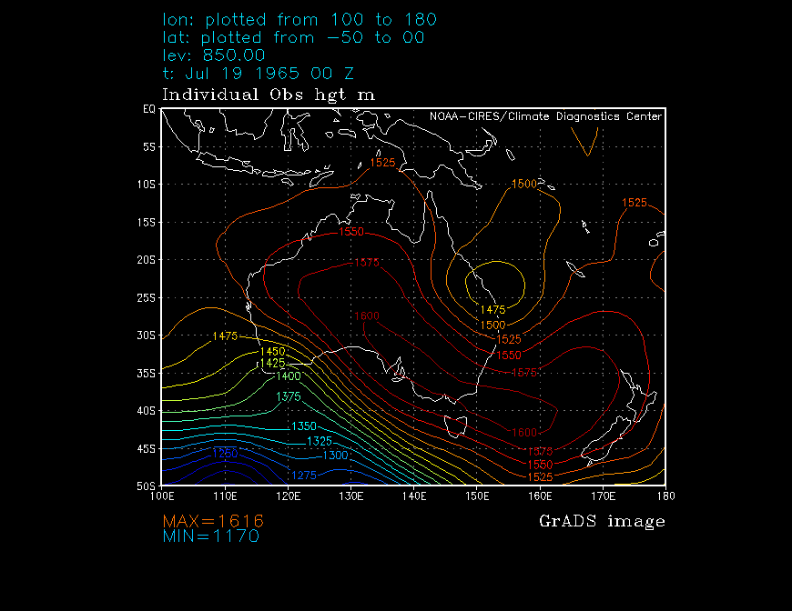
One thing that stands out about this system is the relatively high sea level pressures (and hence 850hPa heights) maintained throughout the event in NSW, the effects of which would have to have been negated somewhat by cold temperatures and availability of moisture to produce the widespread, heavy snow that it did.
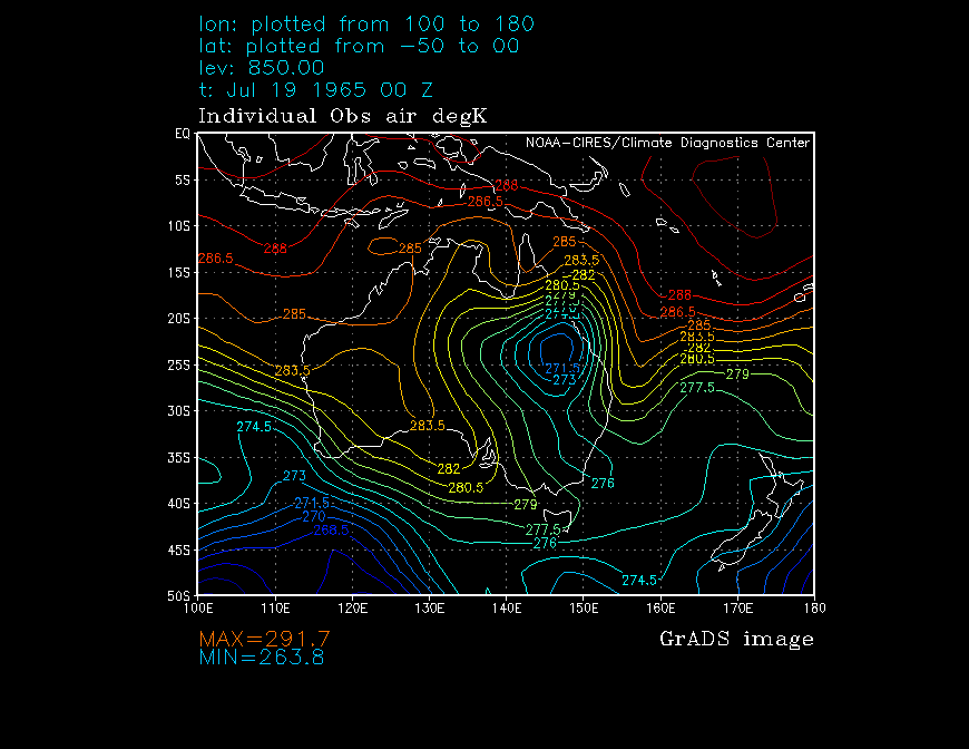
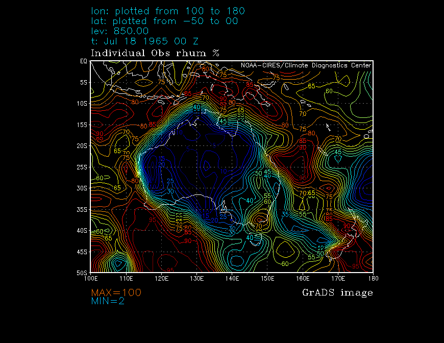
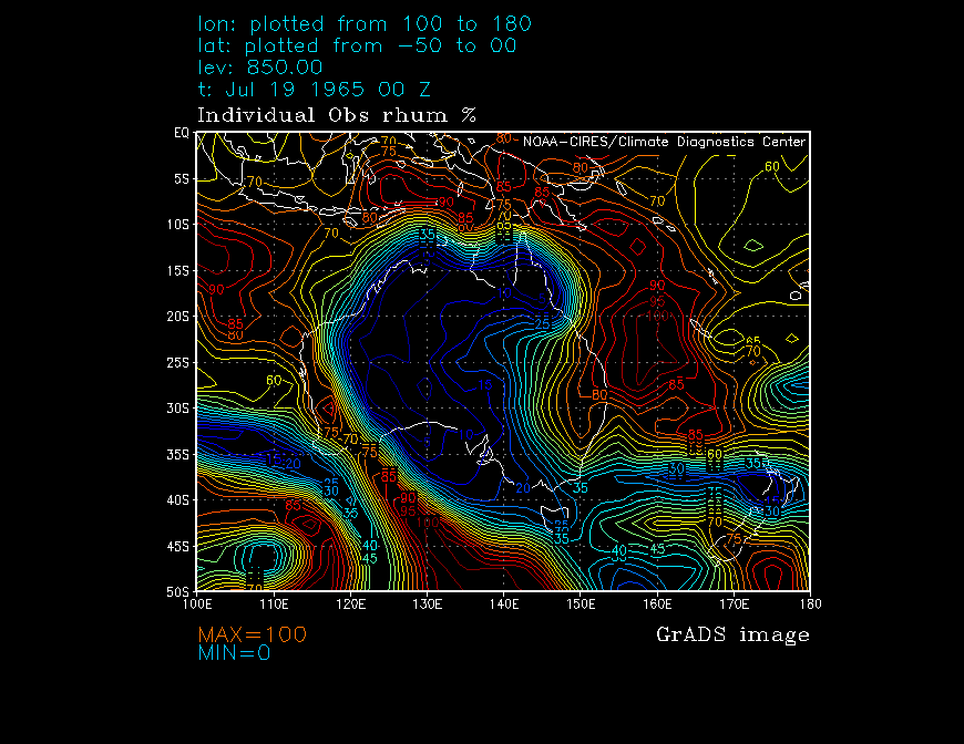
Included below are charts of the reanalysed Sea Level Pressure and 850hPa height, temperature and relative humidity values spanning from the 16th to the 19th at 00Z each day.
| 16/7 00Z | 17/7 00Z | 18/7 00Z | 19/7 00Z | |
|---|---|---|---|---|
| SLP (Pa) | 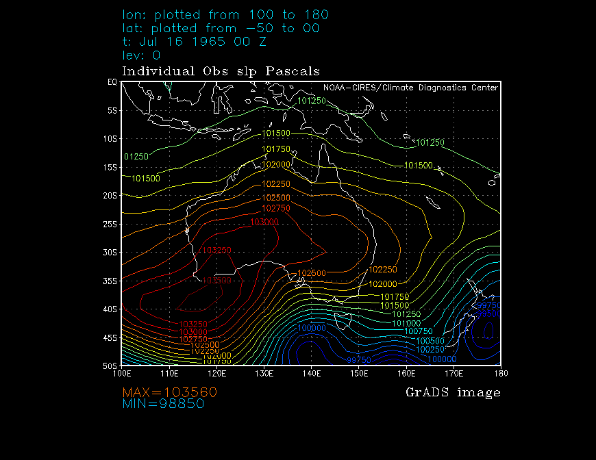 |
 |
 |
 |
| 850 hPa HGT (m) |  |
 |
 |
 |
| 850 hPa TMP (°K) | 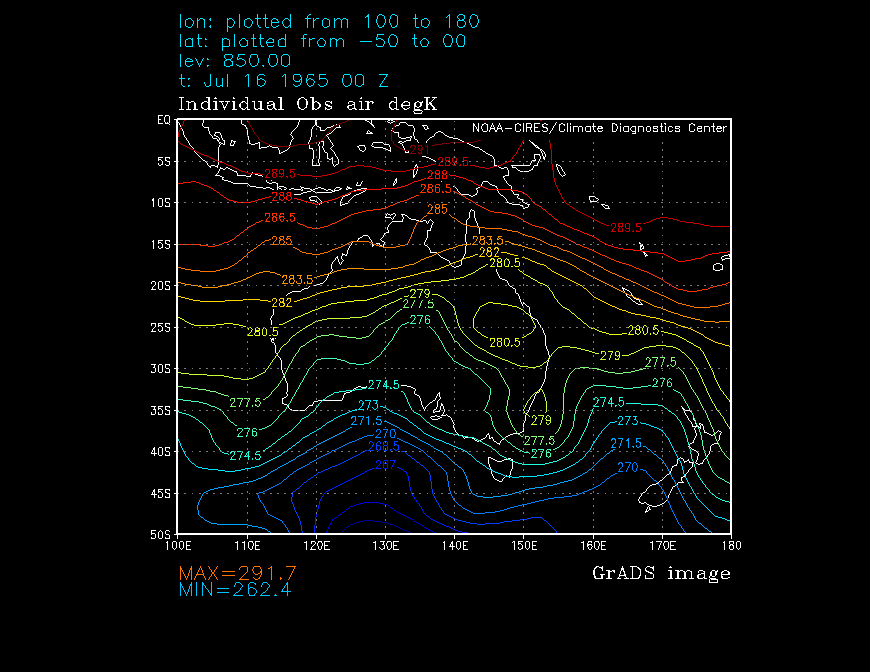 |
 |
 |
 |
| 850 hPa RH (%) |  |
 |
 |
 |
|
||||
Report
The material available for this event suggests that snow fell on most of the NSW ranges, probably above around 500m in the south - ranging from the high parts of the South Coast, north to the Liverpool Range and beyond to the Northern Tablelands and Slopes. Taralga PO reported 6 snow days for the month, some of them no-doubt spectacular.
Below are some images and links to other material covering the event.
The following images and captions were provided by Laurier Williams, and extracted from the Australian Railway Historical Society NSW Digest (August 1965). Laurier's snow page links to the text of the article which describes "the impact of a major snowstorm on the Blue Mountains (and elsewhere in NSW) on railway operations".
 |  |
| The down Central West Express stands at Newnes Junction waiting for the tracks ahead to be cleared. The diesel loco is obscured by the station master...who has cleared enough snow from the platform to keep his feet dry. (Daily Telegraph) | 4437 assisted in the rear by steam loco 5917 hauls a goods train to the top of the Liverpool Range north of Murrurundi. (John Ward) |
 | |
| 4539 at the head of the up Riverina Express during the height of the snowstorm at Goulburn on 17 July 1965. (O. Jacobson) |
The following is an extract from Laurier's own excellent article entitled Snowfalls in New South Wales 1957 to 1979.
"...the snowfall of 17 to 19 July was remarkable for giving widespread, heavy snow away from the Alps. Falls in the South Coast, Hunter, Central Tablelands and Northwest Slopes rainfall districts were among the heaviest and most widespread on record with places in the Northwest Slopes reporting snow for the first time. Heavy snow blanketed the Liverpool Ranges in the upper Hunter and on the Blue Mountains snow fell continuously from about 9:30am on the 17th to 4:30pm on the 18th. Snow in the Katoomba - Mount Victoria area was an average 45cm deep, all roads were impassable and a chaotic train service was kept running by using steam engines to clear tracks."
Below are some images from the Blue Mountains belonging to the Southers family and provided by L. Pearce.
 |  |
 |  |
© Andrew Miskelly | [Back to Index]
Email me using my first initial and last name, no spaces, at ozemail, com, au.