Classic cold outbreak brings second heavy snowfall in a week
Thursday July 5-6, 1990Situation
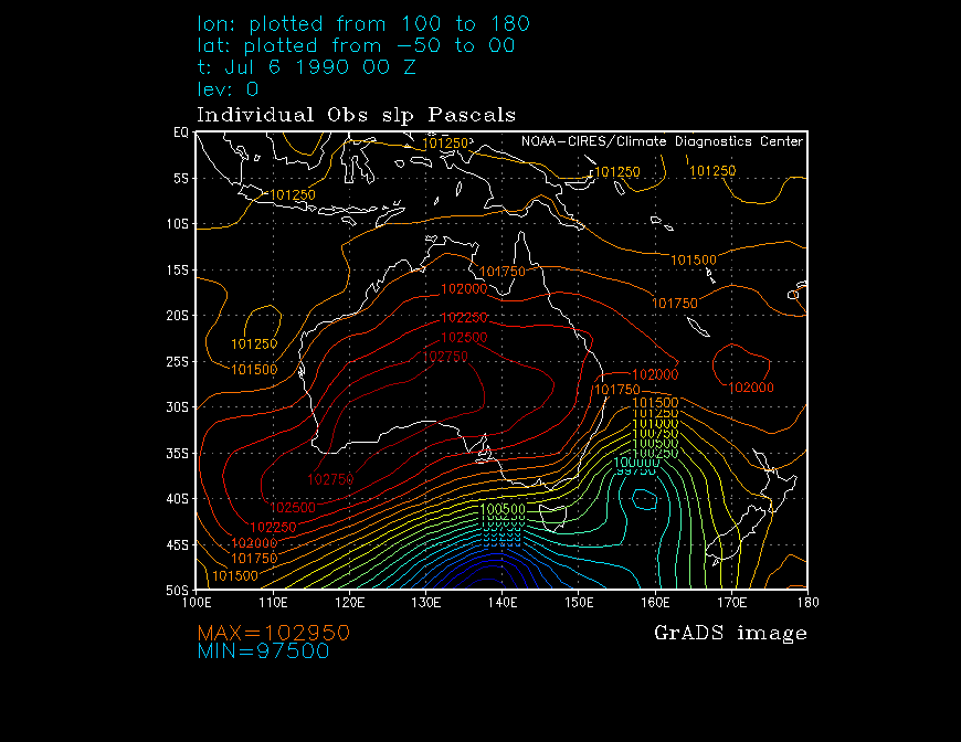
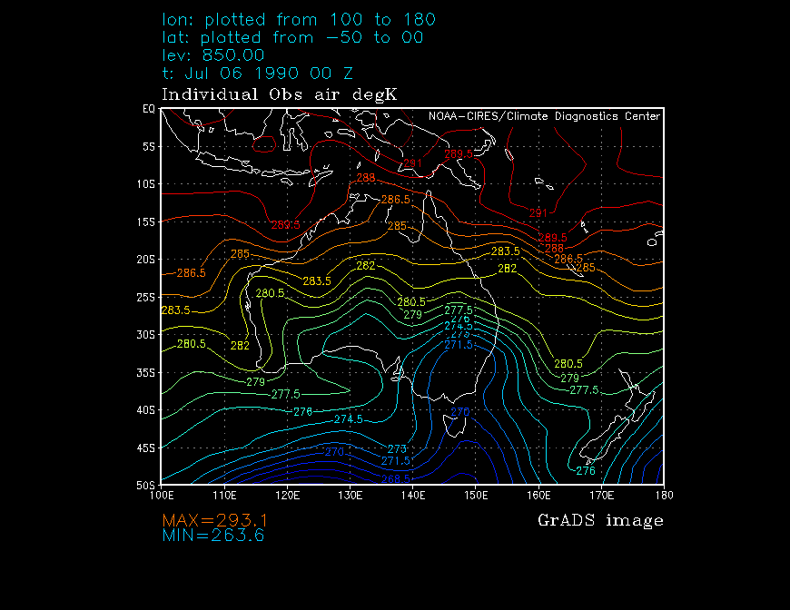
A classic cold outbreak setup with a high near the south of WA, ridging ENE, and a deep low near Tasmania allowed cold Southern Ocean air to penetrate well into SE Australia. The combination of 850hPa temperatures of -2 to -3°C and instability provided by the nearby low produced ideal conditions for widespread snow on and west of the Great Dividing Range.
This situation almost exactly mirrored that of June 27-28, only a week before, where heavy snow had also been widespread in NSW. I believe snow settled on many parts of the Central West Slopes of NSW on the morning of the 28th.
Included below are charts of the reanalysed Sea Level Pressure and 850hPa temperature for 12Z on Thursday (around the time snow commenced in Taralga), and 00Z on the Friday.
| 5/7 12Z | 6/7 00Z | |
|---|---|---|
| SLP (hPa) | 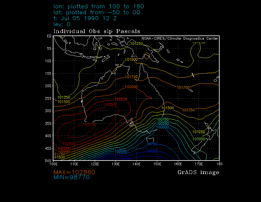 |
 |
| 850hPa TMP (°K) |  |
 |
|
||
Report
With snow still lying in patches on the surrounding hills from the previous week's falls, our area was snowed under again.
The following are a few shots from around our home in Taralga, taken on the Friday morning. The snow lay in patches around the village for a few days and another week again in sheltered areas of the surrounding higher ground.
 |  |
| A snow shower disappearing to the east. | An intrigued feline! |
 |  |
| A couple of the local children (?!) enjoying the scenery. | That damn kid again! |
 |  |
| A recently laid slab getting some of the best curing treatment available. | A rather scratchy shot of the village. Some may recognise the town windbreak in the background, on the right hand side. |
© Andrew Miskelly | [Back to Index]
Email me using my first initial and last name, no spaces, at ozemail, com, au.