Severe downburst damage report, Wiarborough, NSW
Monday February 17, 2003Situation
This was one impressive storm, developing near Yass on the western edge of the Southern Tablelands and travelling along a line through areas near Gunning and Taralga, through the Blue Mountains National Park, and all the way to the south-west edge of the metropolitan area. This day was ripe for storm development on the ranges with an approaching front providing instability, and plenty of moisture available after the non-event of a rain band the previous day which might have dissipated some of it.
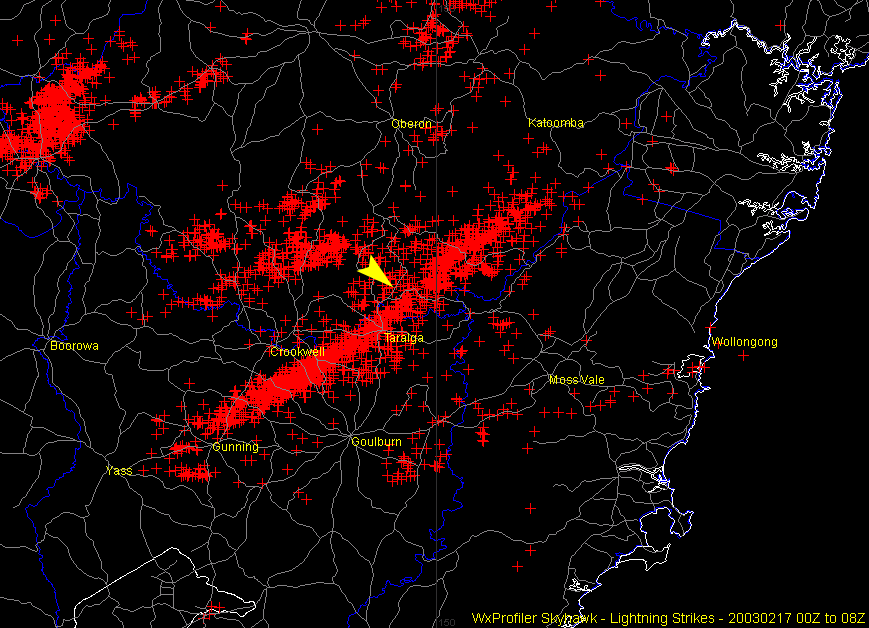 |
| The lightning data for this day clearly shows the path of the storm, and gives an idea of its ferocity. The arrow indicates the location of the Wiarborough damage. |
|
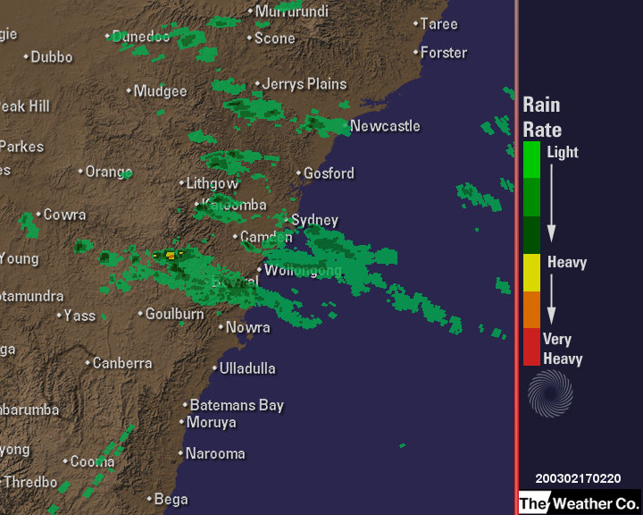
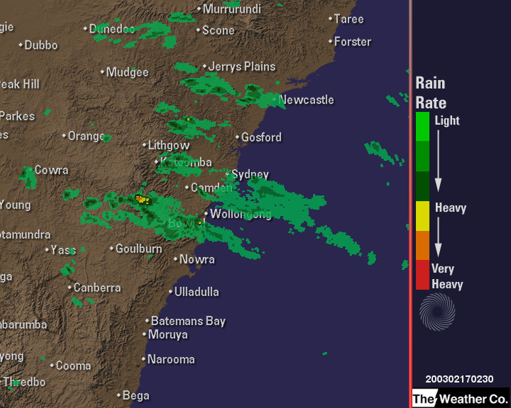
| Radar images of the storm passing through the area. The storm would have hit the Wiarborough area at approximately 1300 hours (0200Z). The images include 0210Z, 0220Z and 0230Z as the 0200Z image was not available. |
As the storm occurred on a Monday morning, all I could do was watch it on radar from the relative calm of Sydney. The only reports available at the time were of small hail and heavy rain in Taralga but as the grapevine spread it became evident that the storm had been far more violent in areas surrounding the village.
Two reports came in in which the term 'tornado' was being bandied about - one from the locality of Roslyn to the village's south west where several hay sheds had been destroyed, and the other near the locality of Wiarborough to the village's north where remarkable damage was said to have been done to trees. With limited time available I decided to investigate the latter myself and follow up the events at Roslyn at a later date with some friends who live nearby.
The Damage
The area in question was a strip of country around the Jerrong Road, between 2 and 5 km north-bound from the intersection with the Wombeyan Caves Road. The locality of Wiarborough is a short distance further along the road.
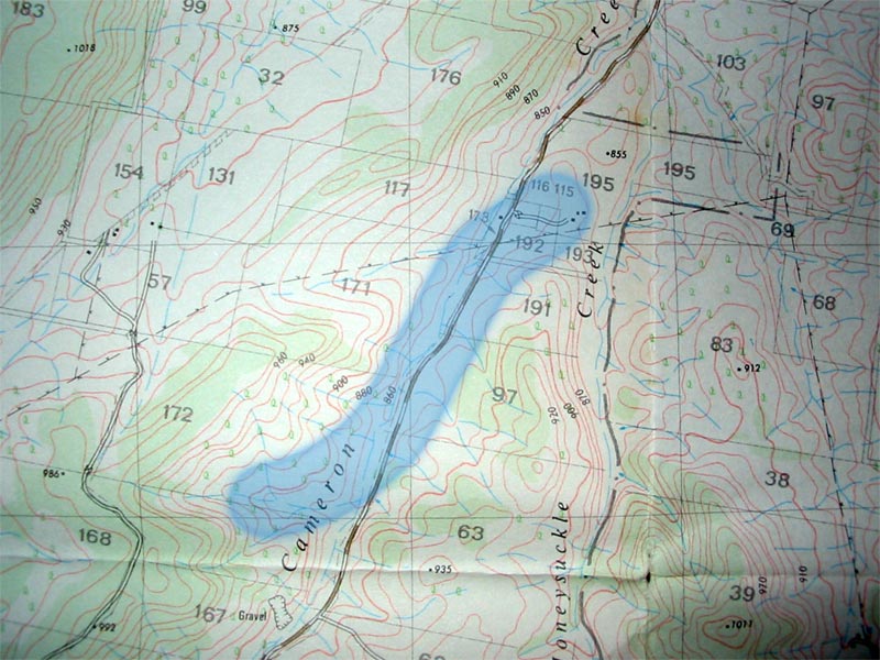 |
| Map showing the nearby area. From the Richlands 1:25000 sheet, 8829-II-N. |
My investigations of the damage provided satisfactory evidence that no tornado had occurred. The damage occurred along a line starting on the western side of a valley and then north along the bottom of the valley where the road and creek ran. I concluded soon after my arrival in the area that a severe downburst had occurred toward the higher, southern end of the valley and coupled with the funnelling effect of the surrounding terrain, sent a massive gust north along the valley until the valley widened and the gust was allowed to dissipate. The evidence of this happening lay in the fact that the damage path started on the western side of the valley, went down to the bottom of the valley before progressing north with all of the snapped trees generally pointing in that direction.
This was eventually confirmed by the two farmers that saw it. Each in their mid-seventies, they recalled hearing the thunderous roar of the gust approaching before seeing it snapping trees in half and throwing them into the air as it swirled around the valley floor.
After my continuous prompts to describe what they saw one of them finally closed the case in the most satisfactory way possible saying "it was a straight wind, not a circle wind". Needless to say, that removed any doubt from my mind.
Images
 |  |
| This is the type of damage that was scattered along the hill side. The Jerrong Road is in the background, running north (left) along the valley. | Numerous trees having been blasted over as the gust rushed towards the bottom of the valley. |
 |  |
| One tree, split in different directions. | The gust seems to have been at its most powerful as it moved along the bottom of tha valley. This was the southernmost damage. |
 |  |
| A mess of broken trees, looking due north with the direction of the wind. | Looking south west up the western side of the valley. |
 |  |
| An extraordinary view of four trees having been snapped like match sticks. | Another massive trunk, snapped in half. I imagine the gust must have been quite abrupt to cause such clean breaks. |
 |  |
| More flattened trees. | A mess of fruit trees at the residence of the two farmers who witnessed the storm. This is towards the northern end of the valley near where the damage ceased, looking due south. |
© Andrew Miskelly | [Back to Index]
Email me using my first initial and last name, no spaces, at ozemail, com, au.